Streamline how you store, access, and manage your core photos—from the field to the office—with Spector Vue.
Introducing Spector Vue
Managing core imagery across multiple rigs, sites, and teams is messy. Files get lost in folders, image quality varies, and workflows slow down as teams dig for the data they need.
Spector Vue is an advanced image management platform built specifically for geoscientific workflows. Whether you’re dealing with legacy photos or live field capture, Spector Vue organizes, processes, and makes your imagery instantly accessible—anytime, anywhere.
Powered by Spector.AI
Built-in AI for image cropping, core markup, and geological interpretation—so your team can log smarter and faster.
Bring in images from Optix, DSLR cameras, historical datasets, handheld devices, and more. Spector Vue supports flexible imports so you can unify all your core imagery—regardless of origin.
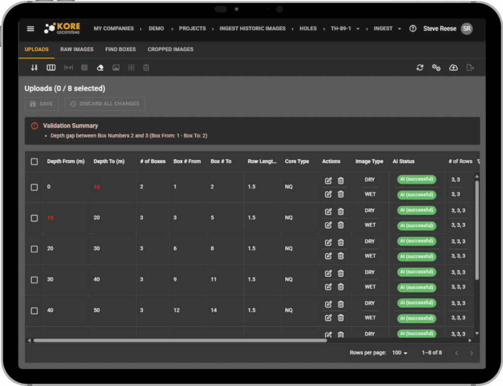
Row View
Easily view your borehole with precise depths derived from digital markup, ensuring effortless navigation, clear visualization, and confidence in depth accuracy.
Data Validation
Instantly detect and identify data gaps and inconsistencies, ensuring every project starts with complete, accurate, and high-quality data you can trust.
AI-Powered Cropping & Structuring
Automated tools streamline image prep, from cropping to standardizing file names and tray layouts.
Centralized Image Repository
Easily manage both historical and newly captured core photos—from drill-side or the core shed—all in one place.
Cloud-Connected Access
Review and manage imagery from anywhere, enabling seamless collaboration between field teams and head office.
Integrated with Spector Geo
All imagery in Spector Vue flows seamlessly into Spector Geo for logging, markup, and analysis.